2021-06-08 Follow up of the Nyiragongo eruption
The seismic data, recorded over the last few days, indicate little change from the situation at the time of the last release on 4 June 2021. Since 31 May, the GPS network and satellite radar imagery have not detected any significant displacement in the region. in the region. Earthquakes and ash fallout could still occur in the coming weeks or months in the weeks or months in the Lake Kivu Basin. Observations suggest that the magma intrusion crisis is no longer evolving. Nevertheless intensive daily monitoring by the OVG and some of its partners continues.
Unless there is a significant change in the situation, there will be no more daily communiqués.
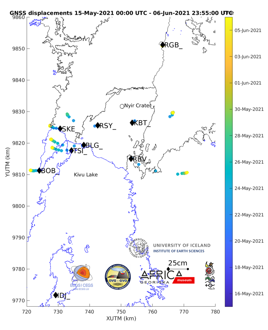
Figure 1: Map showing the horizontal displacements recorded by the GNSS stations of the KivuGNet network. Daily processing (1 point per 24h) between 15-05-2021 00:00 and 06-06-2021 23:55. The black contours mark the historical lava fields of Nyiragongo and Nyamulagira, the blue contours mark the lakes. Data processing by H. Geirsson (univ. Iceland).
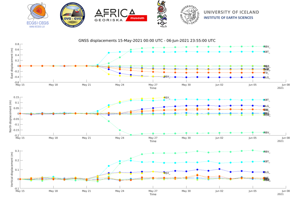
Figure 2: Time series of east-west, north-south and vertical displacements between 15-05-2021 00:00 and 06-06-2021 23:55 for the 8 stations shown on the map above. The period include 7days before the eruption, the co-eruptive displacements on May 22 2021 and the post-eruptive displacements due to magma propagation southward. Data processing by H. Geirsson (univ. Iceland).
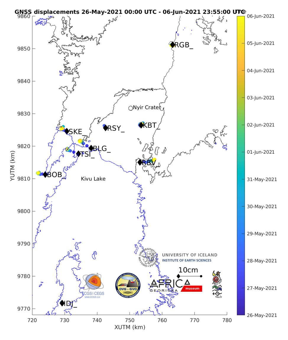
Figure 3: Map showing the horizontal displacements recorded by the GNSS stations of the KivuGNet network. Daily processing (1 point per 24h) between 26-05-2021 00:00 and 06-06-2021 23:55. The black contours mark the historical lava fields of Nyiragongo and Nyamulagira, the blue contours mark the lakes. Data processing by H. Geirsson (univ. Iceland).
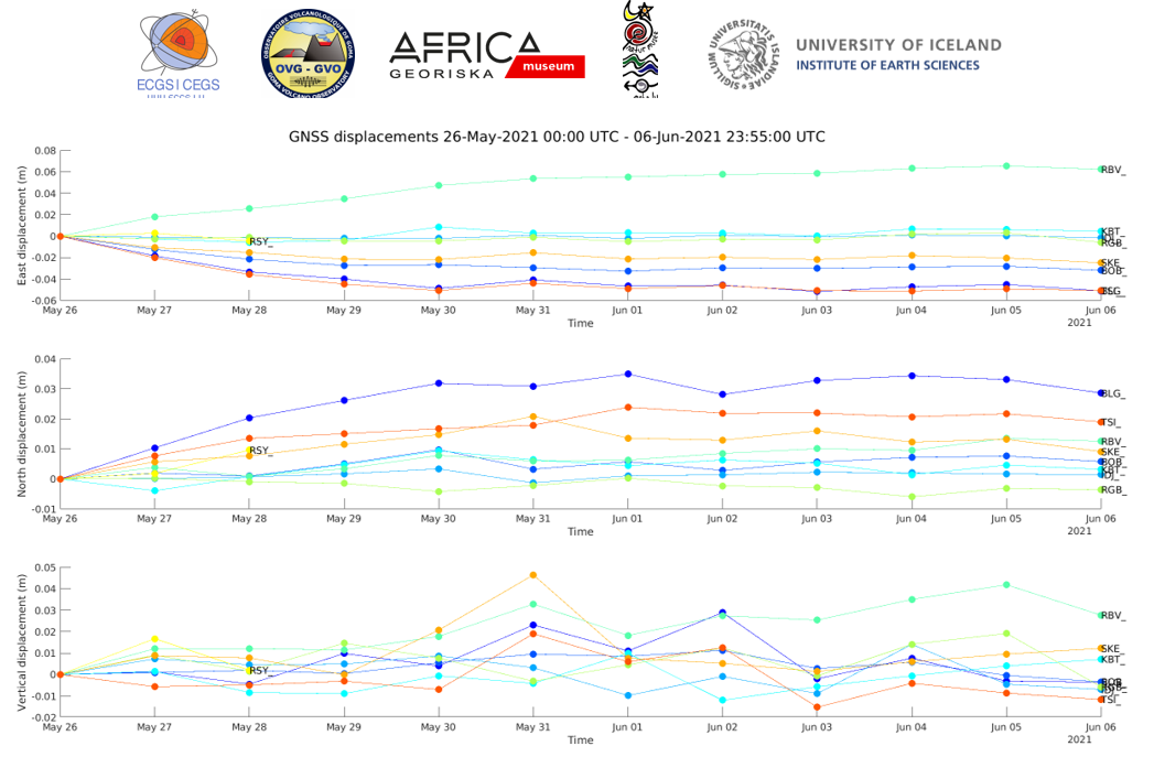
Figure 4: Time series of east-west, north-south and vertical displacements between 26-05-2021 00:00 and 06-06-2021 23:55 for the 8 stations shown on the map above. Significant post eruptive displacements due to magma propagation southward occurred in the days following the eruption. Today, no significant displacement is measured on the GNSS network. Data processing by H. Geirsson (univ. Iceland).
![]()