GeoRiskA | Make the difference together!

logo 


The GeoRiskA research team contributes to addressing the challenges of disaster risk reduction related to geohazards in changing African environments. To achieve this goal and to sustainably address environmental issues, they are developing intensive collaborations with research institutions in Africa. To this end, the team is actively involved in knowledge transfer, capacity building and long-term actions.


  • What we do

    • Scientific Research:
      Identification, analysis and assessment of natural hazards of geological and geomorphological origin (e.g. volcanoes, landslides, earthquakes, flash-floods), and associated population and infrastructure vulnerability and risks.
    • Scientific Cooperation:
      Development of local expertise through capacity building activities, in the field of geosciences.
    • Collections management:
      Map library, aerial photograph archives, geo-database.
         (Visit the online RMCA geocatalogue)
    • Services:
      Scientific expertise on natural hazards and Earth Observation based on a long-standing experience in Africa; Thematic mapping; Valorisation of geo-archives.
  • How we do

    • Strong partnerships:
      With African scientific institutions and key stakeholders such as the civil protection.
    • Capacity building and knowledge transfer:
      Tailored and academic trainings; Support for the development of local scientific infrastructures; Data sharing.
    • Field research:
      Ground-based measurements (instrument networks, GNSS mapping and survey); Image acquisition using Unoccupied Aerial Systems (UAS); Data collection (qualitative and quantitative surveys, Citizen Observer networks).
    • Earth observation:
      Optical remote sensing; SAR/InSAR remote sensing; Time-series analysis; Space- and airborne (historical and UAS) photogrammetry; time-lapse camera systems; GIS analysis; hazard and risk quantification; thematic mapping.
  • Where we work

    • Countries with current partnerships:
      Burundi, DRC, Ethiopia, Rwanda, and Uganda.
    • Main current area of expertise:
      Western branch of the East African rift system (Virunga Volcanic Province, North Tanganyika - Kivu Rift region, and Rwenzori Mountains).
    • Interests for:
      Changing environments, with a focus on urban and densely populated regions; Contexts of data scarcity.


  • For more details on our actions do not hesitate to visit the News, Activities and Outreach pages!
  • The Staff page gives you information on who are behind the GeoRiskA team. The page on our PhD students gives little insights into our actions to train the scientists of tomorrow.
  • The Partnerships page provides you with a picture of our active collaboration networks.
  • Finally, the Publications page gives you an idea of our research outputs.
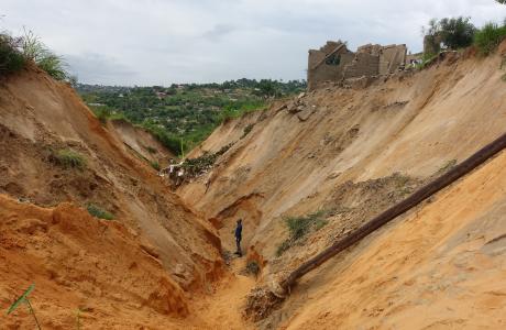
     
Kivu Citizen Observer Network

In the field with the Kivu Citizen Observer Network: Documenting their action in eastern DRC

The Kivu Citizen Observers report various natural hazards, and record their impacts occurring in eastern DRCongo, a region still under-documented. They are real change makers for Disaster Risk Reduction.

Discover in this News other Citizen Science initiatives and related research developed at the AfricaMuseum

READ MORE