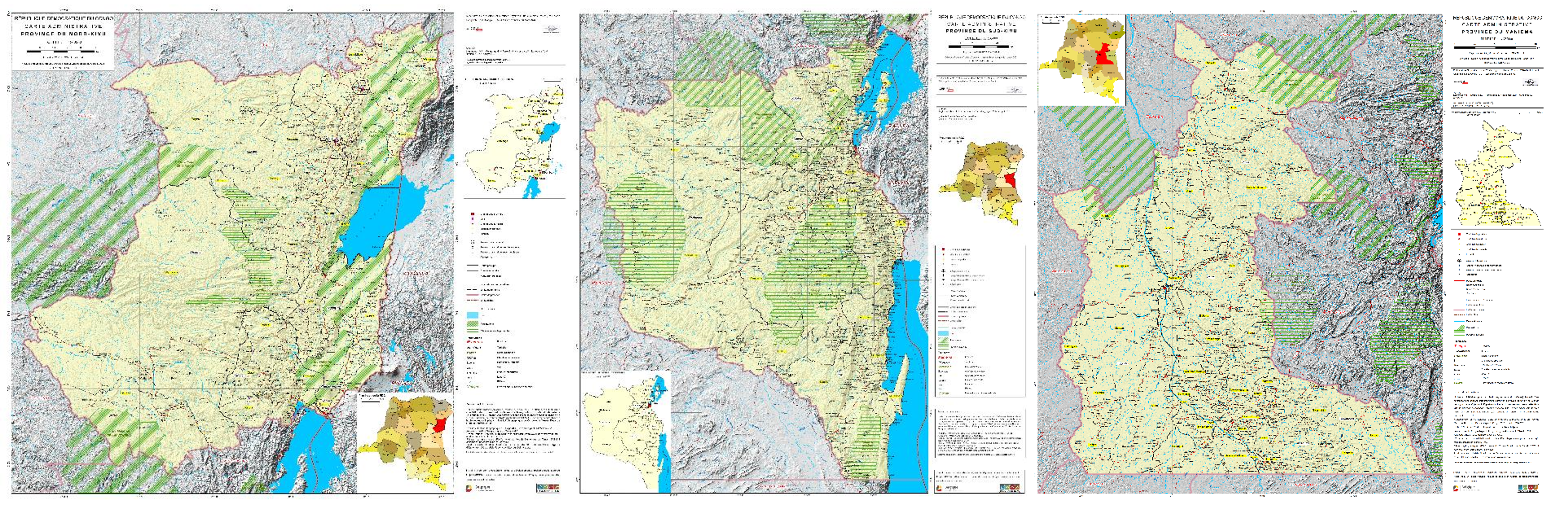
Publication of the administrative maps of the Kivus (DRCongo)
In the framework of the HARISSA project, the Institut Géographique du Congo (IGC), in collaboration with the RMCA, has developed a series of thematic projects focused on updating administrative maps at the national, provincial and territorial levels.
2021-08-18
The preparation of these maps is based primarily on the 2015 organic law ( establishing the boundaries of the provinces and the city of Kinshasa), field knowledge, archival cartographic documents (territory maps from the 1950s), and high-resolution satellite imagery. The IGC stations in North Kivu, South Kivu and Maniema, in collaboration with the RMCA, produced in 2021:
- The administrative map of the province of Nord-kivu at 1/500000,
- The administrative map of the province of Sud-Kivu,
- The new version of the administrative map of Maniema
A series of maps of the territories of these three provinces will be published soon.