2021-05-28 Follow up of the Nyiragongo eruption
Current seismicity and ground deformation data continue to indicate the presence of magma under the urban area of Goma with an extension under Lake Kivu.
In the last 24 hours, seismicity, although less felt by the population, remains high, with hundreds of events per day still being detected by the GVO. In view of these results, we can expect the tremors to continue in the coming days. The location of these events seems to have stopped its progression towards the South but remains localized under Lake Kivu. Surface deformations are still recorded by the GPS network. These observations are consistent with the presence of magma at depth.
Ash fallout may occur as a result of the collapse of parts of the crater.
Data on the stability of Lake Kivu currently show no significant change.
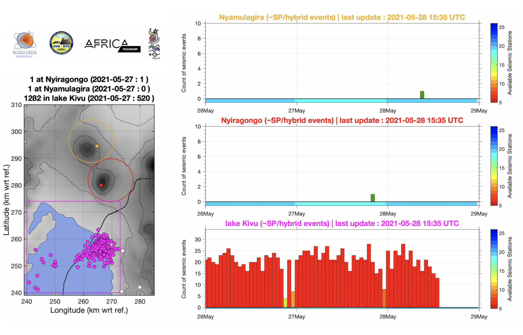
Figure 1: left) Zones for counting seismic events and right) automatic hourly counts of short-period (SP) and hybrid earthquakes in the three areas marked on the map during the last 3 days (from midnight 26 May; last updated on 28 May at 15:35 UTC). Each bar is an hourly count.
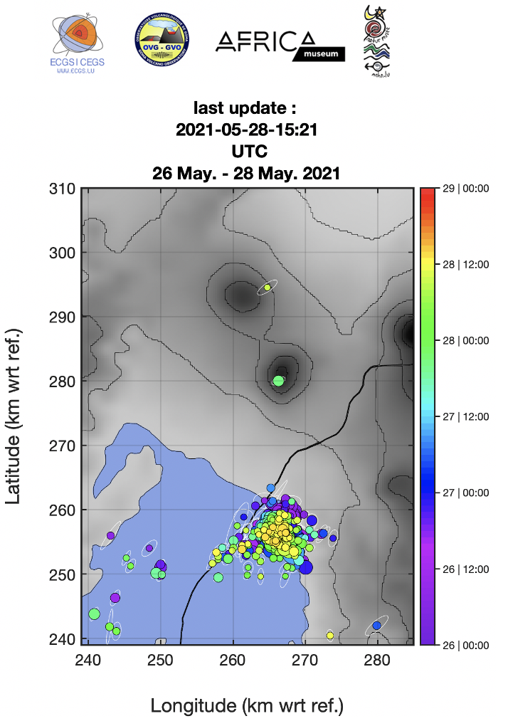
Figure 2: Earthquakes automatically located on 26, 27 and 28 May 2021 (last updated on 28 May at 15:21 UTC) where the colour scale corresponds to the time of origin of each event.
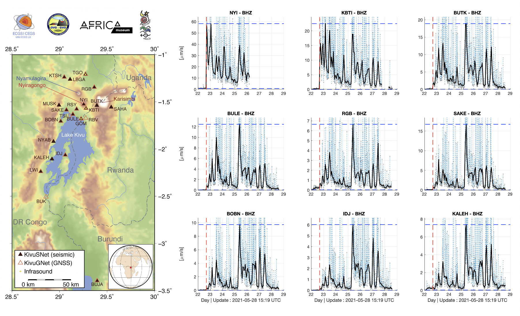
Figure 3: left) Map of KivuSNet stations used for earthquake location maps (see Figures 1 and 2) and right) Seismic amplitude measurements since 22 May 2021 (10-minute windows + moving average, filtered between 2-10 Hz) at 9 stations.
![]()
Figure 4: Map showing the horizontal displacements recorded by the GNSS stations of the KivuGNet network. Processing epoch by epoch, 1 point every 5 minutes between 25-05-2021 00:00 and 27-05-2021 23:55. The black contours mark the historical lava fields of Nyiragongo and Nyamulagira. Data processing by H. Geirsson (univ. Iceland).
![]()
Figure 5: Time series of east-west, north-south and vertical displacements between 25-05-2021 00:00 and 27-05-2021 23:55 for the 6 stations shown on the map above. Data processing by H. Geirsson (univ. Iceland).
![]()