2021-05-31 Follow up of the Nyiragongo eruption
Current earthquake (seismicity) and ground deformation data continue to indicate the presence of magma under the urban area of Goma with an extension under Lake Kivu.
Although there are still earthquakes recorded, their energy is globally lower. Their location and the direction of the GPS displacements still indicate a halt or pause in the propagation of the magma intrusion towards the south. A decrease in displacement velocities measured by the GPS network still seems to confirm these observations. The physical impossibility of installing seismic or GPS stations in the lake makes it impossible to accurately detect any upwelling of magma beneath the lake.
This decrease in energy released by the earthquakes, as well as in the GPS speeds, cannot yet be interpreted as indicating the cessation of volcanic activity. During phases of volcanic activity, periods of higher activity often alternate with phases of lower activity. The results of our analyses still show the presence of magma at depth.
New rockfalls in the crater can cause ash fallout in the surrounding areas.
Visual observations from the OVG confirm that there is no volcanic eruption on the flanks of Nyamulagira.
The possibility of an eruption on land or under the lake cannot be ruled out at this time, especially as some eruptions can occur with few precursors. This justifies the continued intensive monitoring and daily reassessment of the situation by the GVO.
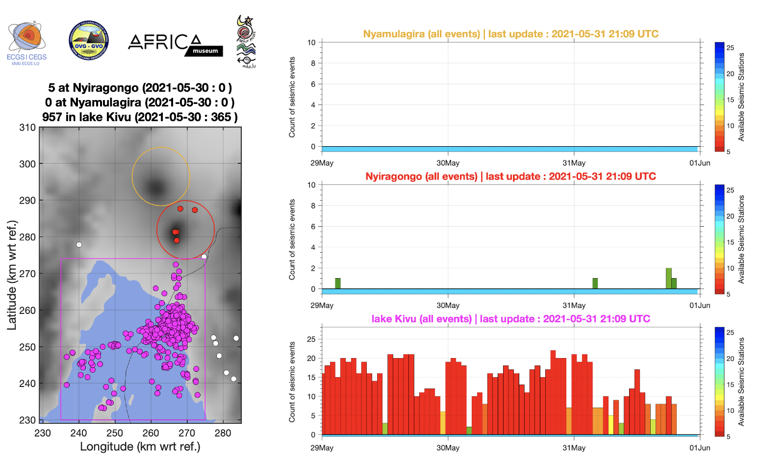
Figure 1: left) Zones for counting seismic events and right) automatic hourly counts of all earthquakes located in the three areas marked on the map during the last 3 days (from midnight 29 May; last updated on 31 May at 21:09 UTC). Each bar is an hourly count.
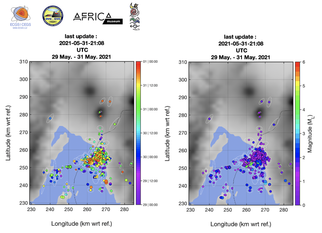
Figure 2: Earthquakes automatically located on 29, 30 and 31 May 2021 (last updated on 31 May at 21:08 UTC) where the colour scale corresponds on left) to the time of origin of each event, on right) to the magnitude of each event.
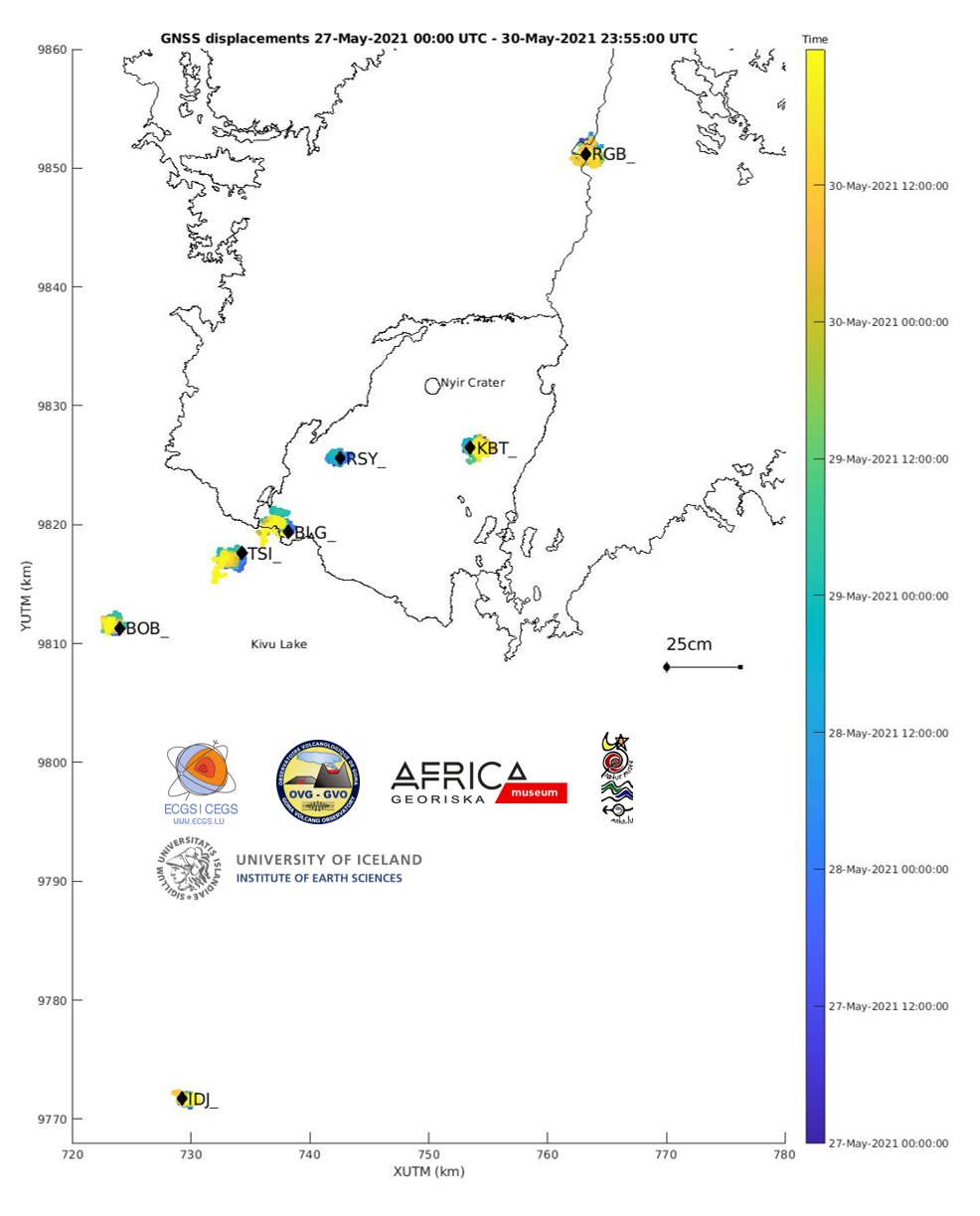
Figure 3: Map showing the horizontal displacements recorded by the GNSS stations of the KivuGNet network. Processing epoch by epoch, 1 point every 5 minutes between 27-05-2021 00:00 and 30-05-2021 23:55. The black contours mark the historical lava fields of Nyiragongo and Nyamulagira. Data processing by H. Geirsson (univ. Iceland).
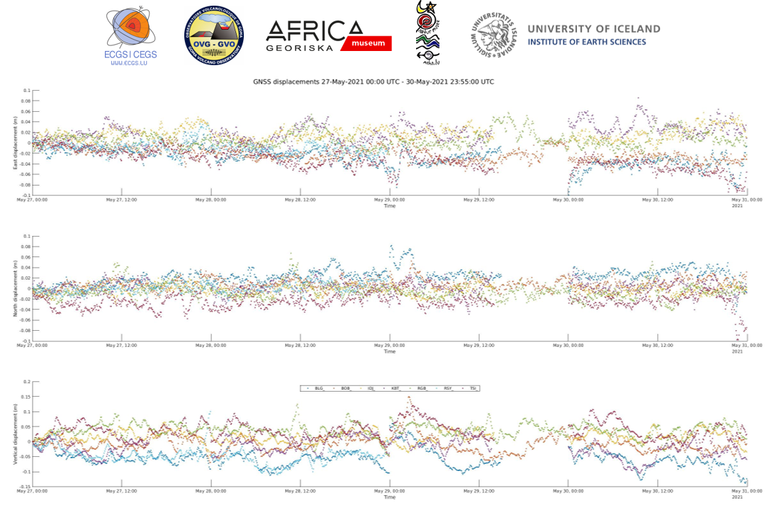
Figure 4: Time series of east-west, north-south and vertical displacements between 27-05-2021 00:00 and 30-05-2021 23:55 for the 6 stations shown on the map above. Data processing by H. Geirsson (univ. Iceland).
![]()