2021-06-02 Follow up of the Nyiragongo eruption
Seismic data, recorded to date, indicate a continuing decrease in the number and magnitude of earthquakes and magnitude of earthquakes (most of them are not felt); the direction is southward under the lake. direction is towards the south, under the lake.
The GPS network still indicates a decrease in the displacement velocities measured at the stations. The physical impossibility of installing seismic or GPS stations in the lake makes it impossible to detect to accurately detect any upwelling of magma beneath the lake.
New satellite data recorded between 27 May and 1 June show that the ground continues to deform south of the town of Goma, albeit at a much slower rate than at the beginning of the than at the beginning of the eruption. These deformations can still create or extend existing ground fractures in the ground.
New landslides in the crater may cause ash fallout in the surrounding areas. surrounding areas.
Overall, the situation is favourable, although a resurgence of activity cannot be completely ruled out. activity cannot be completely ruled out. This justifies the continued intensive monitoring and daily reassessment of the This justifies the continued intensive monitoring and daily reassessment of the situation by the OVG.
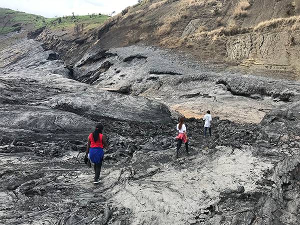
Figure 1: The GVO team on the southern lava flow of the 2021 eruption, mapping the eruptive fissures. Photo (c) B. Smets
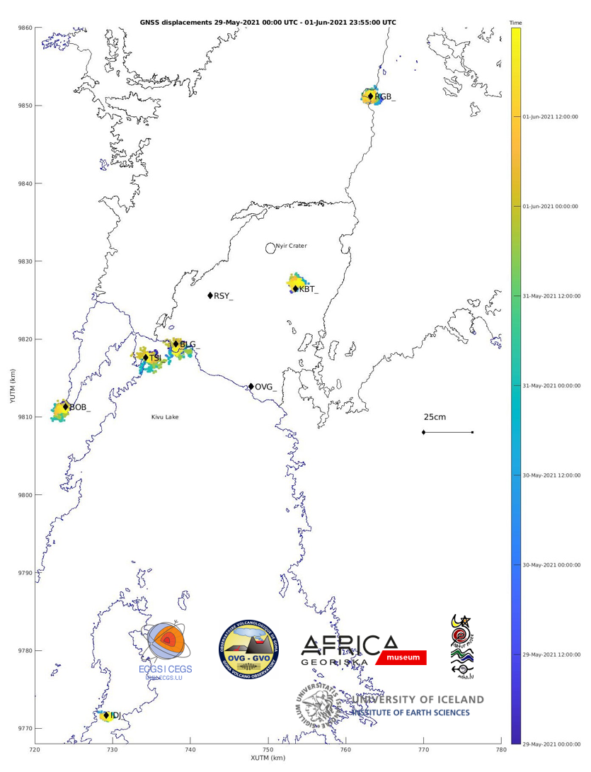
Figure 2: Map showing the horizontal displacements recorded by the GNSS stations of the KivuGNet network. Processing epoch by epoch, 1 point every 5 minutes between 29-05-2021 00:00 and 01-06-2021 23:55. The black contours mark the historical lava fields of Nyiragongo and Nyamulagira. Data processing by H. Geirsson (univ. Iceland).
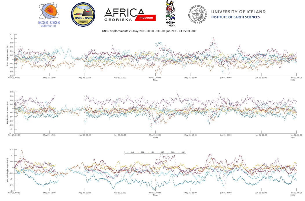
Figure : Time series of east-west, north-south and vertical displacements between 29-05-2021 00:00 and 01-06-2021 23:55 for the 6 stations shown on the map above. Data processing by H. Geirsson (univ. Iceland).
![]()