2021-06-04 Follow up of the Nyiragongo eruption
The seismic data, recorded today, indicate little change from the situation on 3 June. The GPS network did not detect any displacement at the stations today. The physical impossibility of installing seismic or GPS stations in the lake does not allow for the precise detection of a possible magma upwelling under the lake.
Further rockfalls in the crater remain possible and could cause ash fallout in the surrounding areas.
The favourable development of the situation continues, although a resurgence of activity cannot be completely ruled out. This justifies the continued intensive monitoring and daily reassessment of the situation by the OVG.
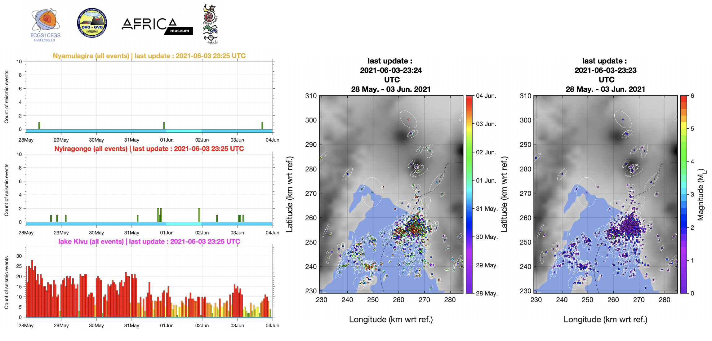
Figure 1: Automatic hourly counts of earthquakes (i.e., each bar is an hourly count) during the last 7 days (from midnight 28 May; last updated on 3 June at 23:25 UTC), whose locations are shown on the maps, where color scale correspond to their origin times and their magnitudes, respectively.
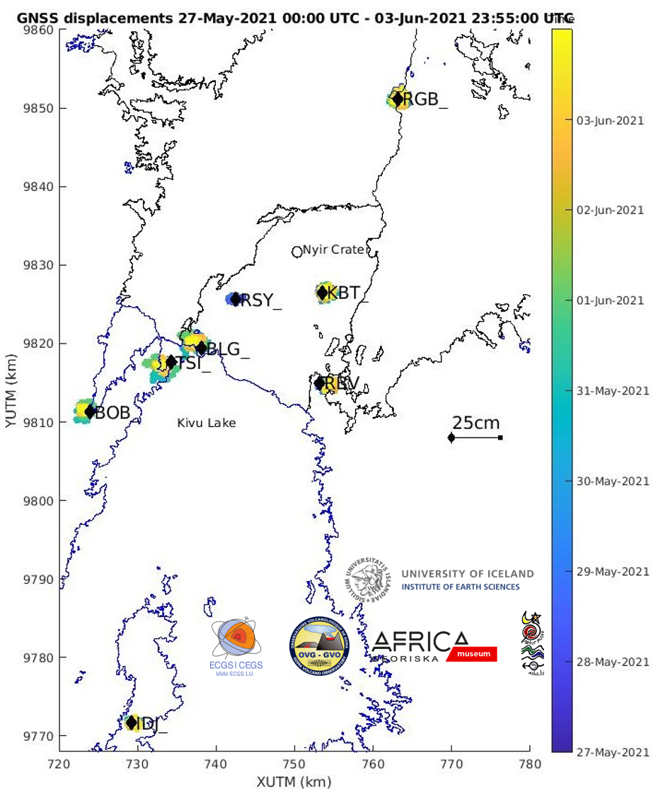
Figure 2: Map showing the horizontal displacements recorded by the GNSS stations of the KivuGNet network. Processing epoch by epoch, 1 point every 5 minutes between 27-05-2021 00:00 and 03-06-2021 23:55. The black contours mark the historical lava fields of Nyiragongo and Nyamulagira. Data processing by H. Geirsson (univ. Iceland).
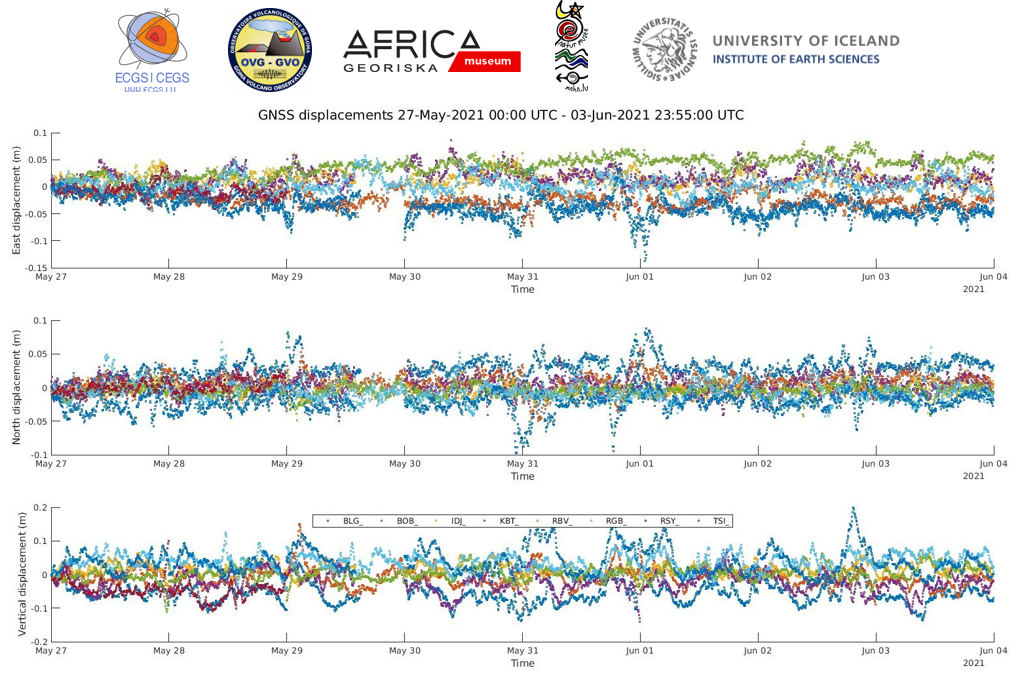
Figure 3: Time series of east-west, north-south and vertical displacements between 27-05-2021 00:00 and 03-06-2021 23:55 for the 6 stations shown on the map above. Data processing by H. Geirsson (univ. Iceland).
![]()