HOMER
Geo-hydrological Hazards in the changing African trOpics: sediments, dynaMics and intERactions
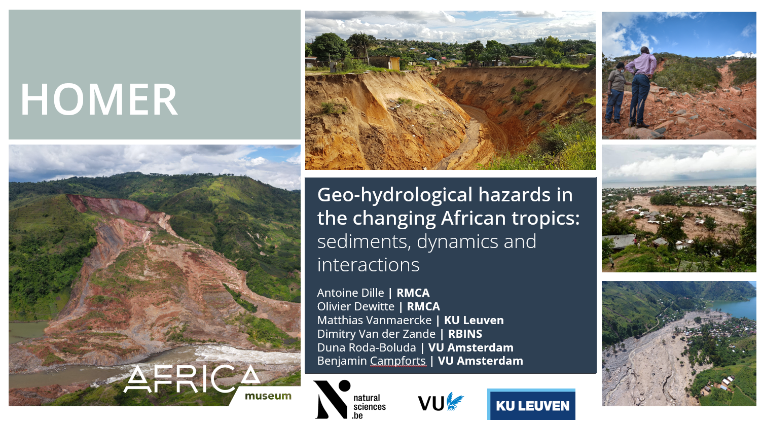
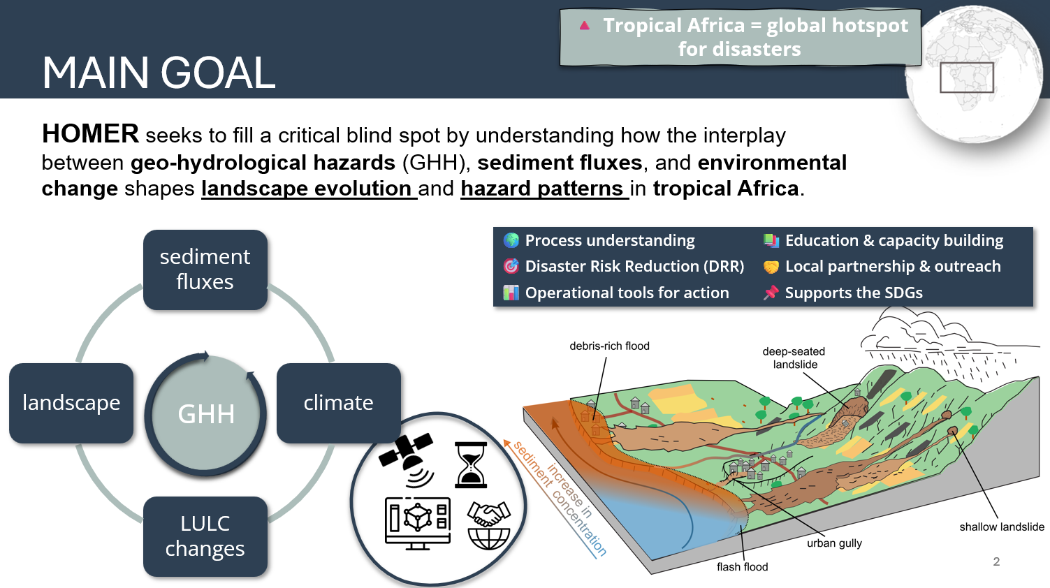
HOMER is a BELSPO STEREO IV project that seeks to fill a critical blind spot in our understanding of how the interplay between geo-hydrological hazards (GHH), sediment fluxes, and environmental change shapes landscape evolution and hazard patterns in tropical Africa. Clarifying those links will help guiding mitigation measures to reduce GHH hazard, soil erosion, flood risk, and environmental degradation—ultimately benefiting public health, infrastructure, and environmental resilience in extremely vulnerable tropical regions.
This 4-year project is coordinated by the Royal Museum for Central Africa (RMCA), in collaboration with de KU Leuven, het Royal Belgian Institute of Natural Sciences en de Vrije Universiteit Amsterdam.
HOMER will demonstrate that it is now achievable thanks to over a decade of systematic, open-access data from Copernicus Sentinel sensors that enable to compile comprehensive, multi-temporal inventories of the full GHH spectrum—encompassing shallow and deep-seated landslides, flash floods, and urban gullies—and to quantify their dynamics, interactions, and cascading sediment impacts over large regions. By exploiting synergies among sensors (primarily Sentinel-1, Sentinel-2, and Sentinel-3), we will detect and track GHH occurrences and dynamics, monitor landscape vegetation recovery, and quantify sediment fluxes. Integration of these unprecedented datasets with data-driven and process-based models will reveal how GHH shape sediment fluxes and drive long-term landscape evolution, with targeted field campaigns for geochronologic sampling offering key calibration parameters for erosion rate models. By integrating these cutting-edge tools with local knowledge and field-based validation, we aim to enhance the detection, monitoring, and modelling of the full GHH spectrum at local and regional scales, ultimately generating more robust and predictive GHH models.
![]()