GIS DAY — GeoRiskA and the use of GIS for natural hazards, risks, and disaster studies

Today is the international GIS Day! This is a nice opportunity to look at how GIS helps the GeoRiskA researchers of the AfricaMuseum in their research and activities.
GIS, which stands for “Geographic Information System”, commonly refers to the set of hardware and software used to store, display, and analyse geographically referenced data. Actually, it is more than that. GIS is a scientific discipline in itself, dedicated to the study and analysis of geospatial information.
For the researchers of the GeoRiskA team, GIS is a commonly used method to help them in their research and activities. Let’s take a quick guided tour at how the GeoRiskA team works with various aspects of GIS in Africa, with their African partner institutions!
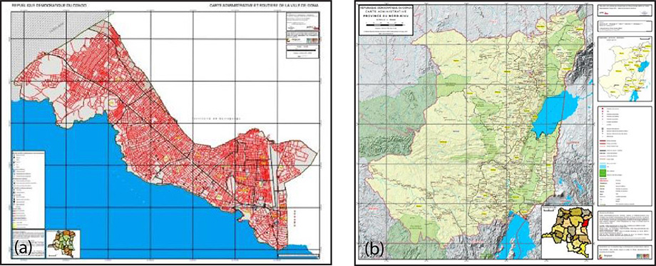
1. GIS for mapping
Cartography is a classic GIS application. At GeoRiskA, we have a long tradition of thematic mapping, dating back to the 1980s. GIS hardware and software are extensively used for thematic mapping in collaboration with several African partner institutions. A specific example is the on-going HARISSA project, in which GeoRiskA collaborates with the Congolese Geographical Institute (IGC) through training and collaborative mapping activities, to foster the availability of Congolese administrative and thematic maps.
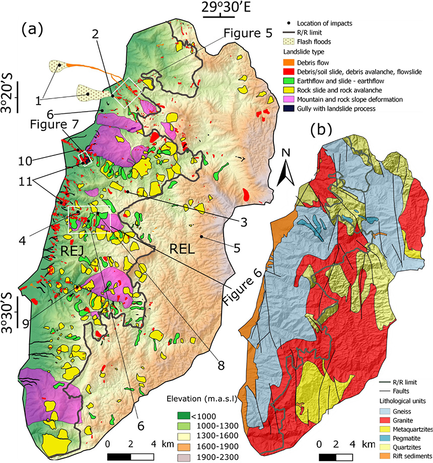
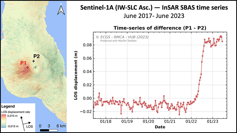
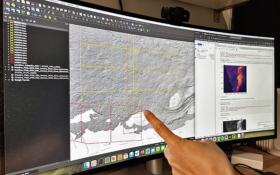
2. GIS for the study of geo-hydrological hazards
The analysis of geodata derived from remote sensing and field surveys is used to assess the spatial-temporal distribution of geo-hydrological hazard processes and events, and create hazard maps. Here are some examples applied to landslides and volcanic eruptions.
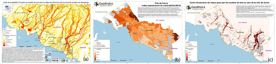
3. GIS for vulnerability, risks, and disaster impact assessments
GIS is a suitable tool for combining various layers of information from remote sensing and field surveys, enabling exposure and vulnerability to natural hazards to be assessed through geospatial analyses. Risk maps can, then, be produced by combining exposure, vulnerability, and hazard distribution maps. Remote sensing and GIS also allow the GeoRiskA team to assess the impact of disasters.
4. Free and open-source GIS
To ensure easy sharing and transfer of hazard risk analysis methods, GeoRiskA fosters the use of open-source software. For this reason, our researchers routinely use software and programming languages such as QGIS, Python and R. In the future, tools developed by GeoRiskA and its partners will progressively be released in open-access to ease knowledge and skill transfer.
Do not hesitate to get more information and updates about our activities, including our monthly geowebinars, by visiting our website: https://georiska.africamuseum.be!